Algeria declares land and space war on forest fires


Algerian President Abdelmadjid Tebboune has decided to reinforce the war waged by public institutions against the plague of fires that each year plague the North African country and that in 2019 devastate more than 21,000 hectares. To strengthen the protection of forest areas and combat the spread of desertification, the President and his Cabinet have taken several important measures that have just been implemented following the activation on June 1 of the 2020 fire-fighting campaign.
They are based on three lines of action which consist broadly in increasing the use of observation satellites, increasing the provision of mobile terrestrial means and promoting international cooperation in fire prevention.
In the space sector, the Algerian Space Agency (ASAL) and the Directorate-General for Forests have reached an agreement to preserve and restore terrestrial ecosystems. The aim is not only to locate, delimit and help control the sources of fires and their spread but also to measure the degradation that burnt land has suffered and to study the evolution of its productivity over the next 10 years.
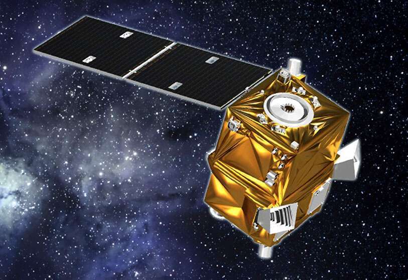
To achieve this, the ASAL has at least two observation satellites in service, one of which is a high-resolution satellite - AlSat-2B, in orbit since 26 September 2016 - and a second, which is less powerful but also very useful for the work, such as AlSat-1B, launched into space on the same date and in the same rocket.
Both space platforms are used primarily to observe the evolution of agriculture and water resources, as well as for the prevention and monitoring of forest fires, locust infestations and the advance of desertification, as well as for the control of large infrastructure projects, environmental protection and mapping.
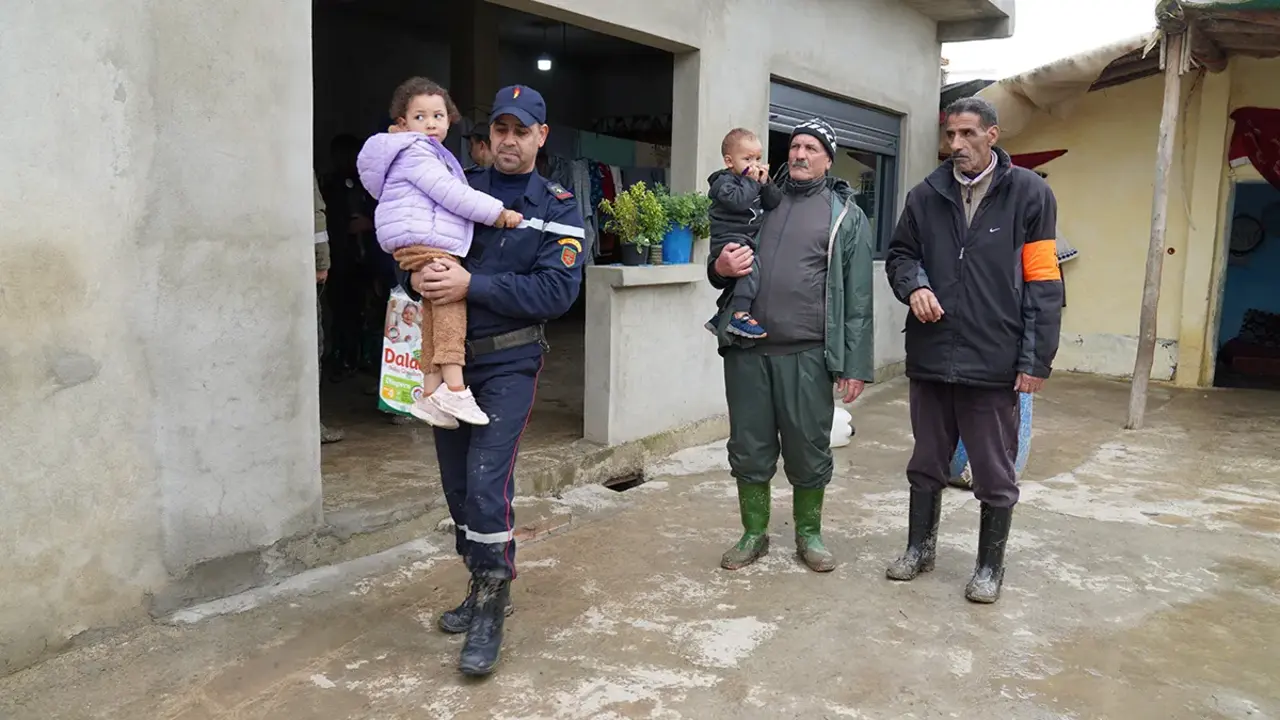
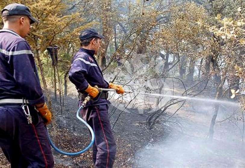
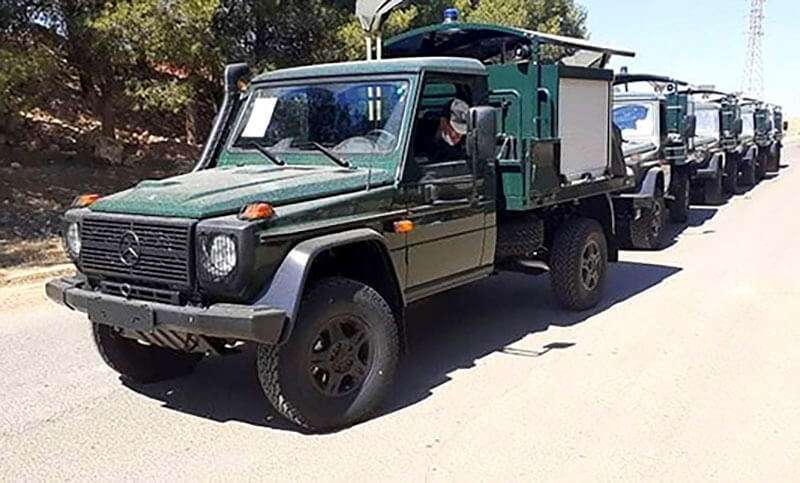
On the ground, the Directorate General of Forestry under the Ministry of Agriculture and Rural Development headed by Chérif Omari has just received 80 new units of Mercedes Benz all-terrain vehicles of national manufacture largely equipped with water tanks. The aim is to enable intervention teams to gain rapid access to the sources of the fires in order to halt their spread, including the desert and the mountains of the Algerian Sahara.
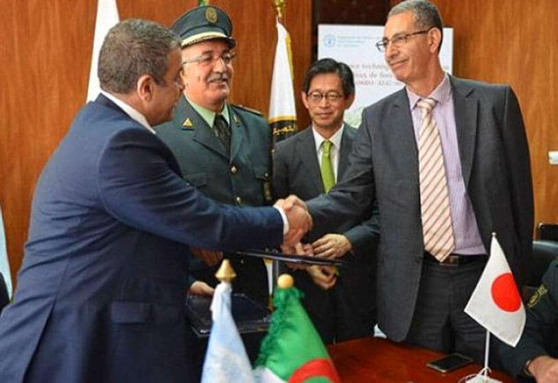
To extend the preservation and protection of forest heritage and strengthen its management capacity in the face of forest fires, President Abdelmadjid Tebboune is also counting on technical assistance from Japan and the help of the UN Food and Agriculture Organization (FAO).
But the main technological combatant in the fight against forest fires is the observation satellite AlSat-2B, which was placed in space at an altitude of 670 kilometers and its sensors provide black and white (panchromatic) images with a resolution of 2.5 meters and 10 meters in color mode (multispectral) of the areas devastated by the fire.
Weighing 117 kilos, in its almost 4 years in orbit, the AlSat-2B has made more than 21,000 orbits around the earth, which is about 900 million kilometres. The satellite has provided more than 73,000 images, nearly half of which were intended to promote sustainable national development and that of the African continent, representing the coverage of more than 10,878 million km² and the downloading of a volume of around 8.73 terabytes.
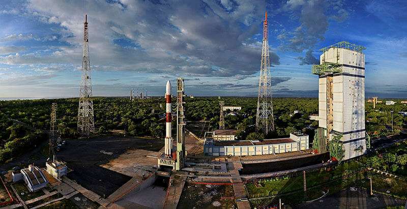
The AlSat-2B is a twin of the AlSat-2A and both were contracted by the Algerian government to Airbus Space Systems France in February 2006. Designed for a lifetime of 5 years, the AlSat-2A was placed in space on 12 July 2010 also by an Indian PSLV launcher. It is known that it was still in service in February 2019, but it is not known whether it is still in full operational condition today.
The AlSat-1B is also located at an altitude of 670 kilometres, but its performance is lower, offering a resolution of 12 metres in black and white and 24 metres in colour. Smaller and heavier (103 kilos) than the AlSat-2, it was contracted in July 2014 and manufactured in the United Kingdom by Surrey Satellite Technology Ltd. It is part of an international constellation to which the government of Algiers belongs and has been providing images and data on natural disasters (DMC) since November 2005.
Before AlSat-1B there was AlSat-1, Algeria's first observation satellite. Manufactured by Surrey and weighing 92 kilos, it was sent into space on a Russian Kosmos-3M rocket on 28 November 2002 and is located 700 kilometres above the Earth. It ended its operational life on 15 August 2010.
The Government of Algiers has managed to determine that fires ruin about 1 per cent of the total forest area each year and that 6 per cent of forest fires are caused by arson. Five per cent are related to agricultural, livestock and recreational activities, three per cent are around coal mines and one per cent are caused by sparks from power lines and railway tracks. However, 85% are produced by unknown causes, a percentage that is intended to be reduced with the help of satellite data and images.
Although Algeria is the largest nation on the African continent and the area burned last year was only a tiny part of its 2.3 million square kilometres, the area destroyed is a quarter of the area lost by Spain that same year - 83,962 hectares - with the difference that only in the northern part of Algeria are there significant forests.